
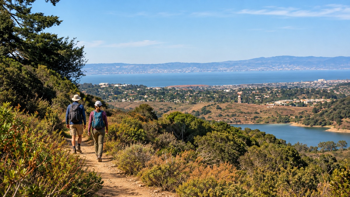
For more than a hundred years, a 23,000-acre stretch of San Mateo County was largely closed to general public access. Now a six-mile trail opens a designated route through the watershed, with features designed to protect drinking water.
- The Skyline Watershed Ridge Trail opened Aug. 24, 2026, after more than 20 years of planning and roughly two decades of construction.
- The route fills a missing link in the regional Bay Area Ridge Trail network and runs off Highway 35 just south of the Highway 92 intersection.
- Careful design keeps foot traffic in one corridor to protect wildlife and the reservoirs that supply local drinking water.
A gap in the network, finally filled
The idea sounds simple. Build a continuous ridgeline trail that stretches across Bay Area counties so hikers, cyclists, and horseback riders can follow the high ground for miles. Making it real took patience. The Peninsula Watershed sat squarely in the path of that vision, and public access to those lands had been closed for generations.
Ryan Fritz, a trail project manager with the Bay Area Ridge Trail Council, describes the goal as creating responsible public access while closing an important gap in the regional network. The watershed had been largely shut to general visitors, yet the notion of routing the Ridge Trail through it goes back more than 20 years. Getting there meant pulling together partnerships across agencies, layers of funding, and environmental review after environmental review.
From feasibility study to finished path
One early piece of the puzzle came from Samuel Herzberg, a retired senior planner for the San Mateo County Parks Department. He took on a feasibility study to test whether a Ridge Trail design could work across roughly ten miles of this terrain. He has compared the work to painting a picture of what the place could become. The study ran about a year and reviewed how such a trail might actually sit on the land.
That groundwork opened the door to the partnership and funding between the San Francisco Public Utilities Commission and the Bay Area Ridge Trail Council. Herzberg supplied the vision and an environmental review of what the trail should be. From there, construction stretched across nearly two decades. Keeping people engaged over that long timeline was its own challenge, Fritz has said, alongside the tougher question of how to let anyone in at all without harming the ground itself.
Built to protect the water
The answer was to concentrate recreation in one designed corridor rather than allow people to wander freely across sensitive land. This is a brand-new trail, not a repurposed service road. It climbs steep slopes and crosses drainages, and it comes with new retaining walls and wildlife-protection fencing. That fencing does double duty. It keeps animals off the path and keeps hikers from straying into vegetation they could damage.
Water is the reason all this caution matters. The Peninsula Watershed feeds three reservoirs in the region, San Andreas Lake, the Crystal Springs Reservoir, and the Pilarcitos Reservoir. Its first job is collecting water for those reservoirs, so the design had to make sure new drainage features and foot traffic would not disturb that function. Litter is the everyday worry. Trash left on the trail can find its way into the water supply that San Mateo County residents drink, which turns a small careless act into a real problem.
More visitors also means more pressure on the animals that live here. As one observer put it, moving more people through any area affects the wildlife, and the hope is that it will not degrade the natural resources people came to enjoy in the first place.
What the trail offers now
For all the engineering behind it, the finished trail reads as a straightforward pleasure. The six-mile route is wide enough to handle hikers heading both directions, and posted signage explains the local wildlife along the way. The payoff is the scenery, including long looks at the water and, on clear stretches, San Francisco itself.
It slots into the larger plan too, adding a working segment to the continuous ridgeline trail meant to serve bikers, hikers, and equestrians alike. After twenty years of planning and building, the trail opens a designated corridor through land long closed to general access. Protecting the reservoirs remains an ongoing responsibility. Staying on the path and carrying out litter are practical ways visitors can help the new route serve both recreation and the watershed.